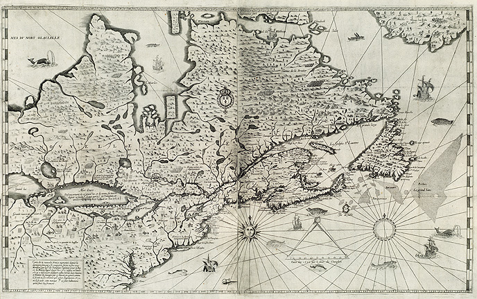
"Map of New France . . . made on its true meridian line by the Sieur de Champlain, Captain for the King," by Samuel de Champlain, 1632
This map by Samuel Champlain shows North America from the northern regions to Virginia and from Newfoundland to Lake Superior.
Used for navigation, it demonstrates Champlain's talent for cartography, which he took up during his first exploration voyages.
It includes much of the information Champlain gathered during his expeditions along the Ottawa River (1613), and as far as
lakes Nipissing and Huron (1615). Published in Champlain's Voyages of 1632, the map is considered to be among his most
important works since he died shortly after completing it.