The Deerfield / Pocumtuck Area
Depicted circa 1550, 1700, and on the morning of February 29th, 1704.
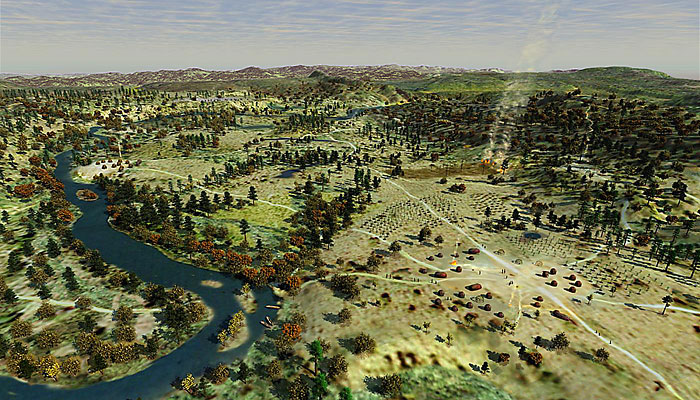
Pocumtuck, circa 1550. This view shows Algonkian land use at Pocumtuck, which means "swift, shallow, sandy stream." Cleared areas are planted with maize (corn), which people in the northeast began cultivating about 1200 C.E. Clusters of wigwams and paths are also shown. Algonkian peoples moved about their homelands frequently, setting up wigwams in different places at different seasons of the year—catching migrating fish in the spring, cultivating fields in the summer, and hunting game in the fall and winter. The result of this mobile lifestyle was relatively "low-impact" land use. Native peoples viewed the landscape as animate, communal territory, supporting both human and non-human inhabitants in reciprocal social and spiritual relationships.
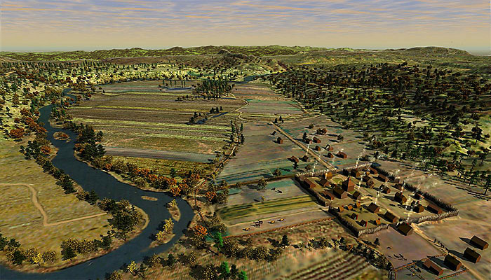
Deerfield, circa 1700. In Connecticut River valley towns such as Deerfield, English settlers created closely clustered villages surrounded by long, narrow strips of land lying side-by-side in large fields enclosed by a single, commonly maintained fence. They brought crops, livestock, and farming methods with them from their home country. Compared to Native land use, the English model was intensive: fixed settlements with larger farms consisting of fields of single crops and herds of livestock that required extensive grazing lands. This intensive agricultural land use disrupted traditional Native hunting, gathering, and agriculture. On lands appropriated from the Native population, the English prospered, and their resulting large families required more land with each generation.
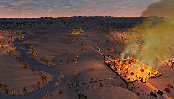
By sunrise on February 29, 1704, much of the English settlement of Deerfield was devastated by the army of French and Native allies.
Images by Will Sillin, © 2004. Sources: Family and Landscape, by Susan McGowan and Amelia Miller, 1996; Captors and Captives, by Kevin Sweeney and Evan Haefeli, 2004; Partial Map of the Deerfield Street and North Meadow, by Joshua Fisher, circa 1690; USGS GIS data and information from advisors to this website.